 Date First Walked: November 13th 2009
Range: Derryveagh Mountains
Mapsheet: 6
Distance: na
Classification: Dillon, Hewitt, Mailyn
Height: 652 metres
County: Donegal
My Dillon Count: 19
Having completed a very enjoyable walk of Muckish, I found myself quickly slipping back into a lazy state of mind back in the car and was in two minds as to whether or not to bother with Dooish. I took a drive out towards the mountain and decided that given that I was in the area and had some spare time on my hands, I might as well give it a go.
Compared to Errigal and Muckish, it's hard to get excited about climbing Dooish. The mountain stands at 652 metres, just a mere 14 metres lower than Muckish. However, from the R251, it appears merely as a hump along the ridge running from Maumlack to Saggartnadooish. From certain angles, Dooish looks quite like a dorsal fin rising gently from the surrounding sea of brown hills. In any case, it was deemed good enough by Paddy Dillon to qualify for inclusion in 'The Mountains of Ireland' so I was going to have to climb it at some stage.
To reach the base of the mountain, take the R251 towards Dunlewy. A few miles after the turn off for Falcarragh, you will see a pull-in point on a straight stretch of road which provides space for parking.
The walk is immediately hard-going over heavy boggy and tussocky ground and I found that the best approach is to keep to whatever high humps and bumps that can be found. There are a few streams to be crossed along the way and after passing under a power line, I had to remove my back-pack to squeeze through the strands of a deer fence. I'm not sure if this fence was to keep the deer in or out but having seen deer earlier in the day at the foot of Muckish, I saw a large group high on the slopes of Dooish which lies on the opposite side of the fence.

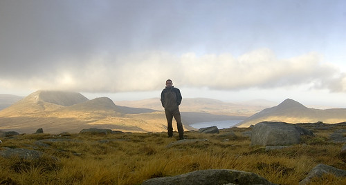
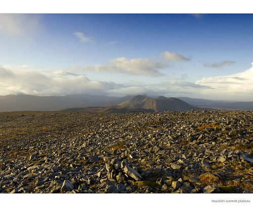
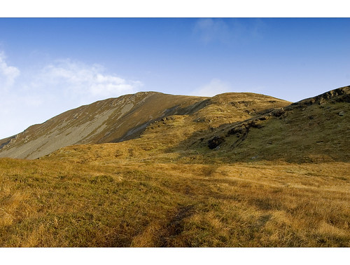
View from the upper slopes of Dooish
View across to the bulk of Muckish from close to the summit of Dooish
The direct line to Dooish is blocked by a small cliff so I picked a path up the east side of the mountain aiming for a gap above the col between Saggartnadooish and Dooish itself. I can only describe Dooish as something of a slog, the ground is boggy underfoot and very steep in places. Dooish is one of those mountains which makes you question your motives for hillwalking as it pulls and drags at your calf muscles with every step upwards. Around halfway up, I threw on my iPod partially to lift my mood but mainly to stop me from constantly reminding myself that I could by now be back at the hotel enjoying a hot shower.
Once more, I had the mountain to myself and I didn't see a single other walker during my time away frmo the car. The only brief company I had was higher up the mountain was I was suprised to see a field-mouse scurrying through some heather.
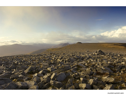
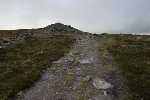
Eventually, the obvious slope leading to the summit came into view and after a short climb in a south-westerly direction, the boggy ground gave way to glorious rock and I reached the welcoming beehive cairn as Morrissey belted out 'Everyday is like Sunday' in my ear. I couldn't help myself but sing along. Despite it's relative lack of height and the fact that it's a short walk, reaching the summit of Dooish felt very rewarding for some reason.
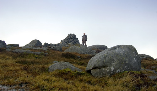
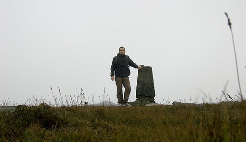
At the beehive cairn marking the summit of Dooish
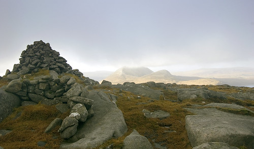
Summit cairn and shelter with Errigal and Mackoght in the background
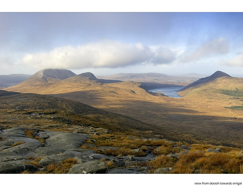
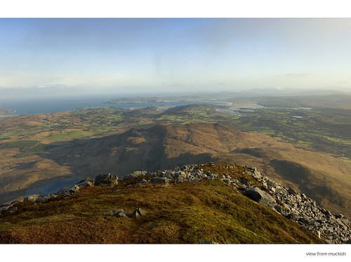
The views from the summit are excellent running from Muckish to the north-east across to Aghla Beg then Aghla More and Errigal divided by Altan Lough and then on across the Glenveagh National Park. Not wanting to face back into the boggy ground I'd climbed up, I set off in a south-westerly direction swinging north at the col to take me back towards the road. Just off the summit is a small weather station of some kind with a data-logger attached, it's small turbine spinning frantically in the prevailing wind. There is some steep and slab-ridden ground to be encountered on the way down but with a bit of care, a route can be picked back down offering great views of Errigal all the way.
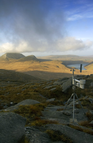
Small weather station just below the summit
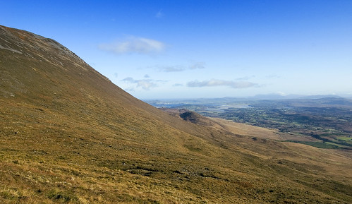
Descending Dooish opens up views towards Errigal, Makoght, Altan Lough and Aghla More
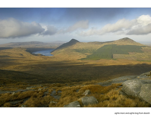
View across to the Aghlas (More and Beg) on the descent
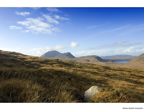
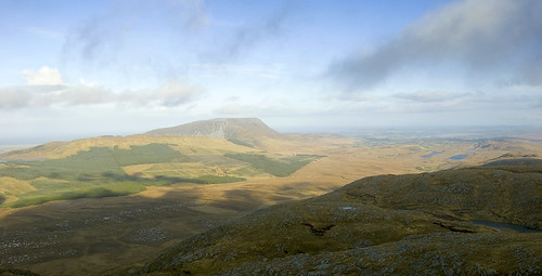
View from the lower slopes of Dooish
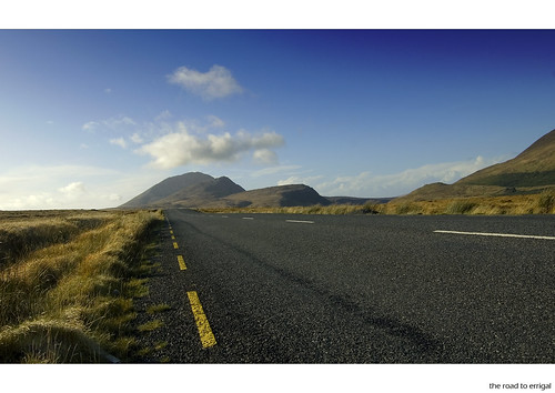
It's a short walk along the road (with great views to Errigal) back to the parking spot
All in all, a tougher climb than it looks mainly due to the steep and boggy ground which probably wasn't helped by heavy rain during the previous week. Despite this, it's a rewarding walk and a good way to get an alternative view of the surrounding hills. Just remember to bring the iPod!
 Date First Walked: November 13th 2009
Range: Derryveagh Mountains
Mapsheet: 2Starting and Finishing Point: See map below
Distance: na
Classification: Dillon, Hewitt, Mailyn
Height: 666 metres
County: Donegal
My Dillon Count: 18
While driving towards Dunlewy to climb Errigal a couple of months previous, I was met with the spectactular sight, as I rounded a corner, of Muckish sitting illumniated under a vivid rainbow as the surrounding landscape lay hidden under heavy rain. I hadn't been familiar with this mountain beforehandbut on returning from Donegal, it had become a mountain that I really wanted to climb so when I found myself back in the area unexpectedly for a weekend, I made time to head back to the North-West of the county.
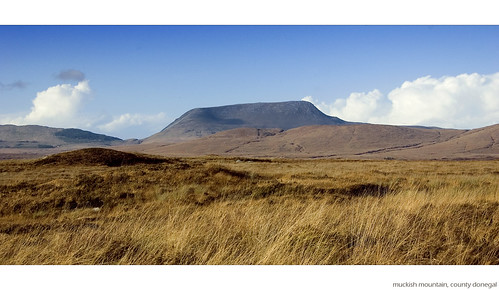
In any other area, this distinctive mountain would be an iconic landmark but given that Errigal is just a few miles away, Muckish somewhat understandably tends to get overlooked for it's famous neighbour. The Irish name of the mountain is 'An Mhucais' which translates as 'pig's back', a name which derives from the distinctive flat-top of the mountain. The flat top is crowned with a huge cairn which is visible for miles around as well as a metal cross which sits on a stone pedestal to the Northern end of the summit plateau. The southern end of the summit plateau gives way to an intimidating looking rocky cliff face.
There are two recognised routes up the mountain, one is via Muckish gap to the South with the second tougher option being via the 'Miner's path'. This follows a precipitous winding path up the northern side of the mountain, part of which was used by workers to reach an old and now defunct quarry where high grade quartz sand was mined on the it's flanks. Given that I was on my own and also the fact that I am a bit of a coward, I opted to take the easier option.
I approached the mountain from Letterkenny taking the turn onto the R255 towards Dunlewy a few miles after Kilmacrenan. This road meets the R251 from which spectactular views open up to the impressive south-east face of Muckish. The cairn atop the mountain can clearly be seen along this stretch of road and as you round several corners, you get the feeling that you are driving right into the mouth of this unusual mountain. Continue along the R251 until you see a sign for Falcarragh (An Fal Carrach). Take this turn which brings you up to Muckish Gap. There is a roadside shrine at the highest point of the gap and there is room to park either at the shrine or on the righthand side of the road just after the shrine.
Parking spot for Muckish View Larger Map
Approaching Muckish
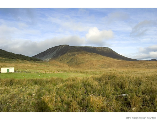
At the foot of Muckish
From the parking spot, cross some boggy ground after which a short climb towards the obvious gap leads to a track. Follow this track which climbs very gently around the mountain and after a short walk, first the cross on the Northern edge of the summit will come into sight followed by the cairn to the southern end of the summit. At this point, you need to pick a path up the steep slope of the mountain and as you gain height, a rocky path just below the plateau leading towards the cairn will come into view.
Aim for the obvious gap at the start of the climb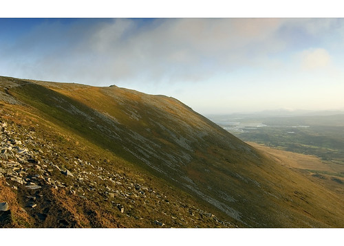
Climbing the south-eastern slopes of Muckish towards the large summit cairnThe last part of the climb along the rocky and peaty path leads onto the rock-strewn summit plateau of Muckish and it's fair to say that it really is otherworldy up there, somewhat akin to walking on the moon. After passing some smaller cairns, you will reach the massive cairn and from there, a very enjoyable walk takes you over to the trig pillar beyond which lies the large metal cross. The cross was placed on top of the mountain in 2000 replacing a wooden one which was destroyed in a storm. I'm not a fan at all of crosses on mountain summits but perhaps this one is understandable given the summit's spot height!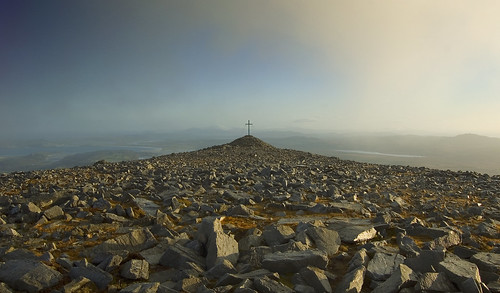
The cross on the Northern edge of the plateau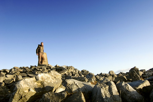
Me at the trig pillar - just a tad breezy!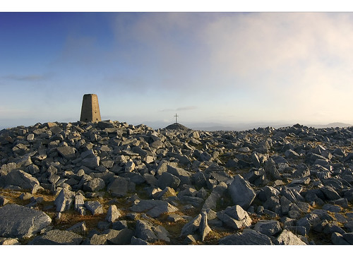
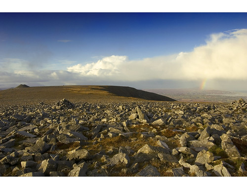
Muckish summit furnitureFrom the cairn, there are fantastic views along the route of the famous Glover Highland Walk taking in the Aghlas, Makoght and Errigal. The rocky hump just below the cross on the opposite end of the plateau offers contrasting panoramic views along the northern coast of Donegal taking in Rosguill in the foreground and stretching to Fanad as far as Inishowen dominated by Slieve Snaght and it's surrounding hills. As I stood at the trig point to take a couple of photos, a vivid rainbow briefly formed over Bloody Foreland to the North-West.
Rainbow over Bloody Foreland
After several rainy days, I had struck lucky and my walk along the summit was made in splendid November sunshine albeit with a biting gusty wind. The rocky plateau really is a wonderful place and is a real pleasure to walk although I have heard that it can be quite disorientating in mist.
View from the northern edge of the plateau
View along the plateau back towards the summit cairn
I retraced my steps back down the mountain towards my parking spot. For the duration of my walk, I had not seen a single soul with my only brief company being a couple of deer who were making their way along the foot of the mountain.
Muckish quite simply is a wonderful and unusual mountain, easily walked from the Gap and highly recommended. While Errigal understandably hogs the limelight in the North-West of Donegal and is obviously and essential visit, make sure to combine a walk up it's glistening quartize slopes with a walk along the iconic and magnificent pigs back of Muckish.
More Photos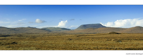
The wild north-west - Muckish and surrounding hills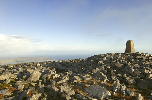
Trig Pillar marking the summit of Muckish - Horn Head in the background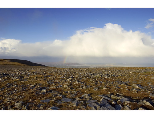
Rainbow over Bloody Foreland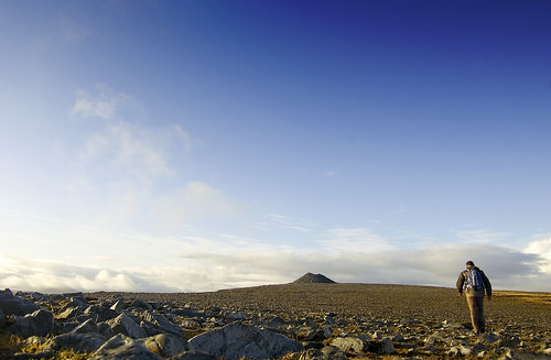
Walking back towards the cairn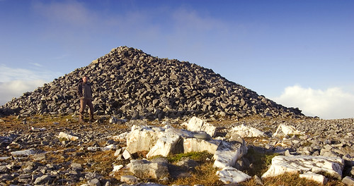
At the summit cairn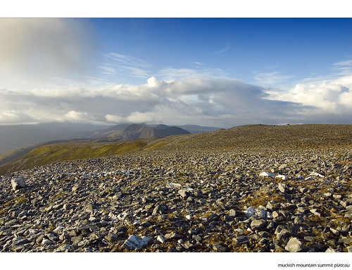
Looking along the summit plateau - descend via the path to the left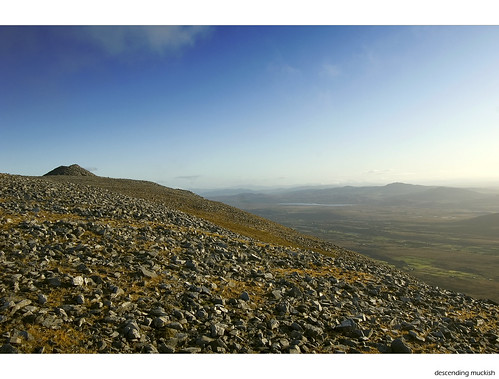
Descending Muckish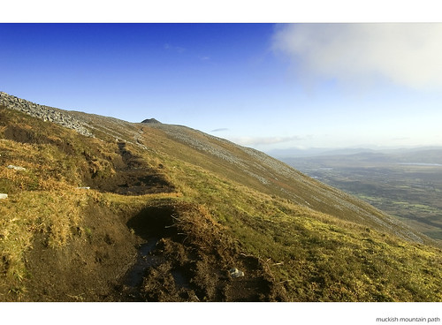
The eroded track back down Muckish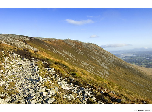
Rocky patch leading back down Muckish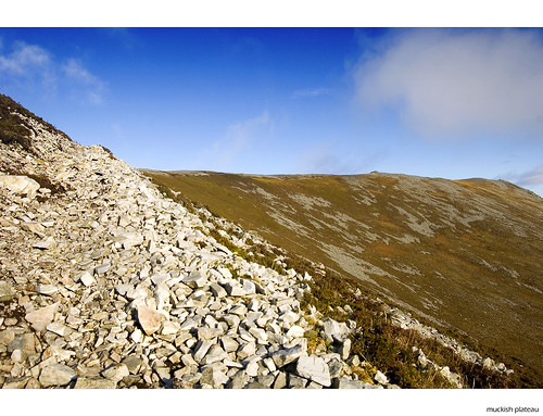
The long summit plateau of Muckish<
View from the lower slopes of Muckish
 Date First Walked: November 4th 2009
Range: n/aStarting and finishing point: Kilcash (see map below)
Mapsheet: 67
Distance: 5km
Classification: Dillon, Hewitt, Mailyn
Height: 721 metres
County: Tipperary
My Dillon Count: 17
Slievenamon is yet another Irish mountain steeped in legend. It's Irish name, Sliabh na mBan, translates as 'mountain of the women' with the story going that Fionn Mac Cumhaill decided to choose his bride from a group of women racing to the top to meet him sitting at the summit. The first to reach the top of Slievenamon was another legendary Irish figure Grainne, albeit with some assistance from Fionn who showed her a short-cut.
Driving from Waterford to Clonmel, Slievenamon comes into focus after the village of Mooncoin appearing as a striking and isolated heather-covered dome standing over the low-lying green countryside. Even from a distance, the wide track that offers easy access to the summit of the mountain can be clearly seen.
Slievenamon can be reached from Waterford by following a series of by-roads but the easiest way is to get yourself onto the Kilkenny to Clonmel road from which you can take the turn off for Kilcash about 10km before Clonmel. From here, a drive along some minor roads leads ever uphill into the small village. Continue on through the village following the signs for 'Slievenamon Drive' until you come to a sign for 'Slievenamon Summit'. Park up here and follow the track leading off from the left-hand side of the road.
Starting Point for Slievenamon View Larger Map
Given the folklore surrounding Slievenamon and having recently read that it is regularly used as a venue for mountain races, I decided to throw on my runners and have a go at jogging up the mountain. After all, how hard could it be? The answer was that it was quite hard indeed and way beyond mere mortals like myself. Those mountain running folk must be made of stronger stuff than I am as it wasn't long after I'd crossed the gate at the top of the track and started up the open slopes of Slievenamon that I had to stop for water. After a couple of short bursts of jogging, I quickly downgraded my plans to a brisk walk to the top.
The walk up Slievenamon is as straightforward as it gets. From the road, take an initial path beween walls which leads to a gate providing access to the open slopes of the mountain. Even at this point, there are expansive views across the surrounding low-lying lands and over to the Comeraghs which appear to tower over Slievenamon. Simply follow the wide distinct track which climbs gently and eventually leads to a cairn at a false summit. From the cairn, pick your way along a vaguer track to the summit proper. The summit is marked by a rather folorn looking trig point as well as a mysterious standing stone and a huge cairn which is said to mark the entrance to the Celtic underworld.
Being November, my visit to the top was accompanied by very strong winds and cloud cover so I was only offered fleeting glimpses out at what looked like excellent and very extensive views across to the Comeragh and Galtee Mountains. A very vivid rainbow to the East hinted at moisture in the air and I was only starting into the descent when the heavens opened and threw down a prolonged shower of hailstones. The onset of more inclement conditions gave me an excuse to try my hand at running down the mountain and while this proved an easier task than running upwards, it presented challenges all of its own. I can only describe my running style as something of a 'semi-controlled fall' but it was great fun all the same!
The popularity of the mountain showed itself in the fact that as I jogged down the mountain, I was met by several different groups of people making their way up towards the now completely cloud-covered summit. Obviously the locals are a hardy breed!
All in all, a handy and safe walk which would be very suitable for children during the summer months. Don't bother with the rest of the 'Slievenamon Drive' afterwards as it really is a non-event consisting of a crawl around some increasingly dilapidated and narrowing roads without offering up any worthwhile views.
The large cairn on the summit of Slievenamon, reputedly the entrance to the Celtic underworld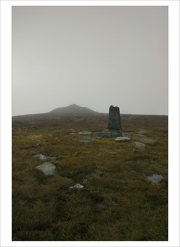
Trig Pillar on the sumit of Slievenamon
