 Wednesday,14th September 2011
Staring and Finishing Point: Glennandaree Bridge
Length: 10.4km
Knockmealdown
Classification: Dillon, Hewitt, Marilyn, County Top
Height: 795 metres
Dillon Count: 48Knockmoylan
Classification: Dillon, Hewitt,
Height: 768 metres
Dillon Count: 49
Sugarloaf Hill
Classification: Dillon, Hewitt
Climbed Previously
After a summer of seemingly incessant rain, I was suprised to find myself in a position where I had a few evening hours to spare in relatively decent weather whilst working for a couple of days down in county Tipperary. After a quick study of my map, I decided to head for the nearby Knockmealdowns. My target was Knockmealdown itself, the highest point of County Waterford. The added bonus is that the mountain comes with a 2nd 2,000 footer free, that being Knockmoylan which is only a very short stroll away.
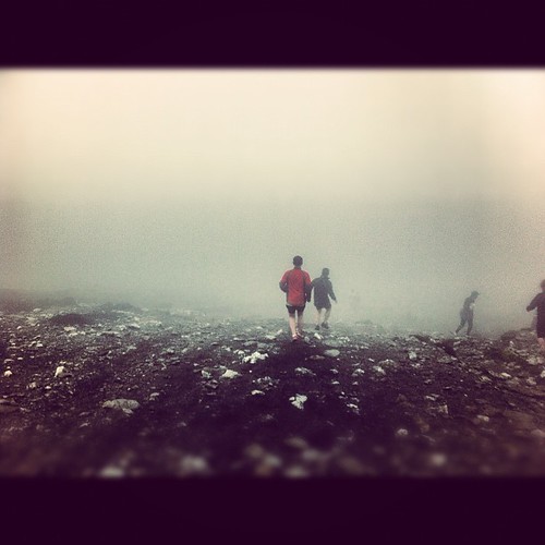
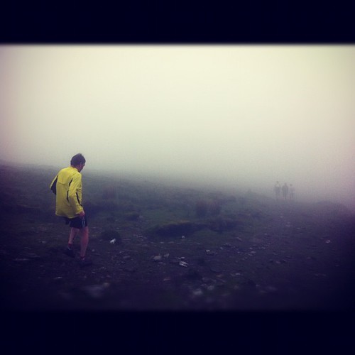
I had a couple of previous encounters with the Top of Waterford without having actually set foot on it. On one occassion, I had ventured up nearby Sugarloaf Hill on an extremely misty morning but decided not to bother crossing over to Knockmealdown given the conditions and the complete lack of views. On another occassion, we again opted out of walking the range having spent the previous day on the Galtees taking in the highest point of the Premier County. Our excuse that time was again a thick blanket of mist covering the mountains but the truth was that it all looked like too much hard work after a night spent sampling the hostelries of Clogheen. If anyone finds themselves camping in the rather quaintly named Pallas Green campsite just outside clogheen or staying in village itself, I have to recommend taking a visit to the not-so-quaint yet very unique establishment that goes by the name of Halley's Pub. It is the kind of place that you very much have to take for what it is, the only small nod towards modernisation being the TV installed in the corner to show Hurling matches or recordings of past Hurling matches. There is every chance that the TV was also showing matches from the future on the night we visited, you'll have to trust me when I say that it just is that kind of place! If the pub doesn't fall down around you, I can almost guarantee that you will have an improbably good time!
From Clogheen, you drive out to the dramatic hair-pin bend at the Vee Gap which was supposedly constructed as part of the famine relief scheme in the 1840's. Close to the Gap is the Bianconi Hut, an old stone building which was a stagepost to provide relief to horses after the seemingly incessant climb up to the Vee. The hut was named after Carlos Bianconi, an Italian emmigrant who was the founder of public transportation in Ireland at a time preceding railways. Bianconi established regular horse-drawn carriage services on a nationwide basis in the early 1800's.
Shortly after The Vee is Bay Lough, a well-known Corrie lake at the foot of Knockaunabulloga. Locals will tell you that the Lough is inhabitated by 'Pettitcoat Loose', a woman of loose morals who was banished to the lake after casting her spell over a multitude of men. She was supposedly sent to the far bank of the lake to spend eternity attempting to empty it with a thimble and the story goes that she can be seen on occassions sitting on the bank trying in vein to carry out her impossibly mundane task. Indeed, few if any people will swim in the lake for fear of being pulled under by it's folorn inhabitant.
A walk of the Knockmealdowns can be started from a number of locations from the Vee onwards but I decided to start from the foot of Knockmealdown itself at Glennandaree Bridge. There are a couple of parking spots here to take a number of cars.
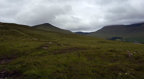
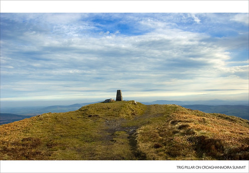
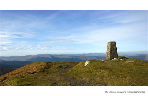
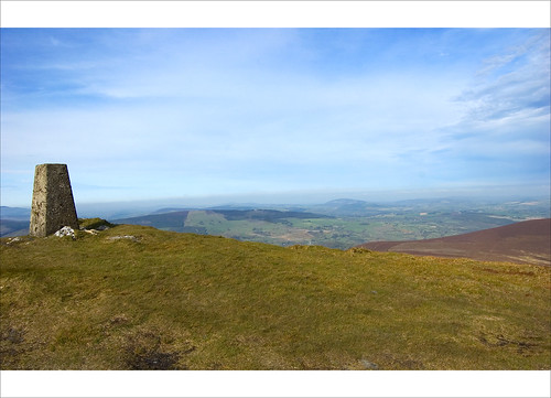
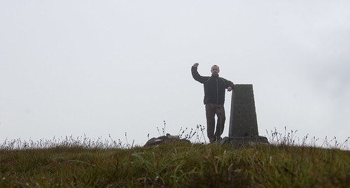
From the parking spot, make your way up the gentle slope veering slightly away from the Glennandaree Stream. The going is pretty easy initially but there is some heather to be encountered on the lower sections of the mountain. As you gain height, the heather relents and the ground becomes rockier as you approach the summit. The distance from the bridge to the top of County Waterford is approximately 2.5km. The summit stands at an impressive 794 metres and is marked by a trig pillar. I recently spoke to a woman whose ancestors carried the raw materials to build the trig pillar to the top of Knocmealdown and she and her family carry on the tradition by climbing the mountain each year. There are very steep falls nearly immediately from the trig pillar to the North of the mountain so care should be taken on a misty day.
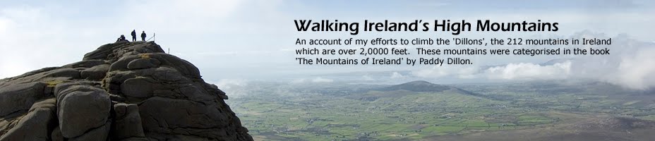
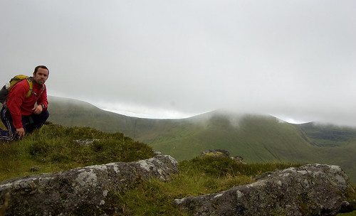
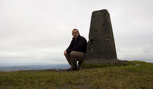 Me at the Trig Pillar on Knockmealdown
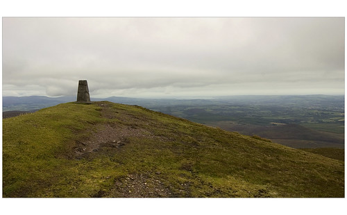 Trig Pillar on Knockmealdown
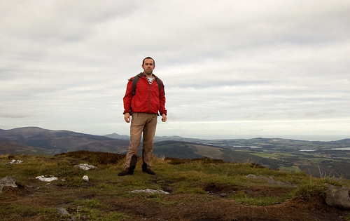
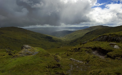
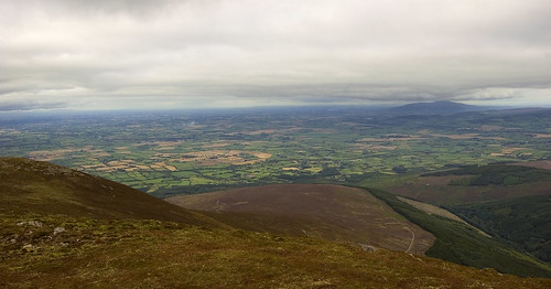
Although the day was overcast, I was treated to really extensive and exceptional views. The overriding feeling standing at the trig pillar is that you are surrounded by an array of mountains which rise rather majestically from the flat plains of patterned and coloured fields which immediately surround the range. To the North-East sits the spectactular bulk of Slievenamon whilst due East are the impressive Comeraghs. Looking North-West leads the eye to the long and majestic range of the Galtees. It's only to the South that the hills relent to give views along the South coast and out to the Celtic Sea.
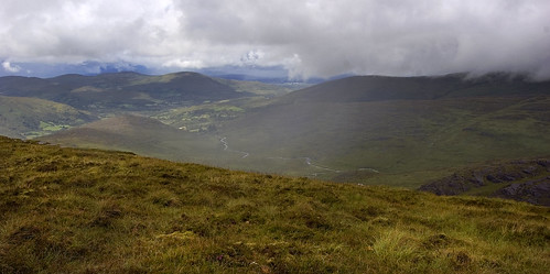
Having bagged Knockmealdown, the walk across to Knockmoylan was very straightforward. Indeed, Knockmoylan barely qualifies as being a seperate summit but it is well worth a visit. Simply follow the remnants of the county wall before branching off in a North-East direction to the cairn standing at 768 metres. Again, the views are extensive particularly out across the plains of Tipperary over to the Galtee Mountains.
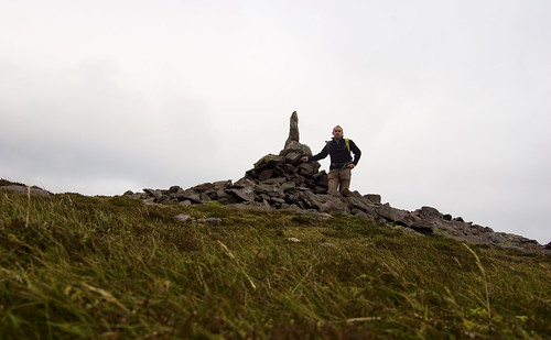
At the summit cairn on Knockmoylan
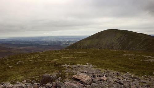
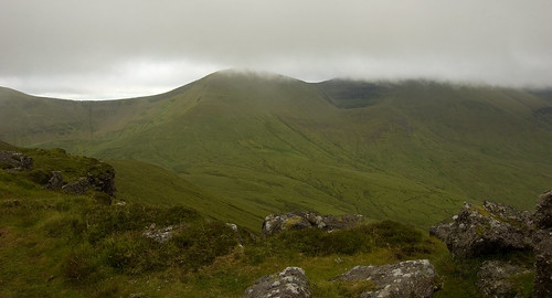
Looking from Knockmoylan across to Knockmealdown
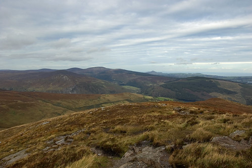
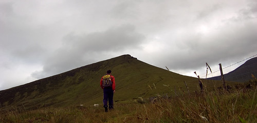
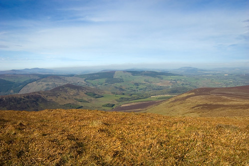
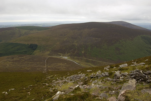
Making good time, I decided to complete a short horseshoe by following the county wall over to Sugarloaf Hill which I had bagged previously in a heavy mist. The crossing from Knockmoylan to Sugarloaf Hill along the ridge is over some of the easiest high ground I have walked on, so much so that I managed to jog most of it. To reach the summit of Sugarloaf Hill, you need to make a diversion from the County Wall at the place where it heads downhill. From there, it is a steep but short walk over rocky ground. The mountain is marked by 2 summit cairns, the second of which is the highest according to my GPS. Again, the views really are exceptional and probably my favourite of the walk, reaching out across the patchwork of colourful fields that make up the Golden Vale.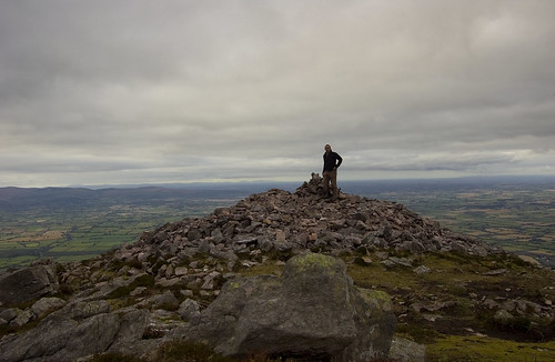 At the summit cairn on Sugarloaf Hill
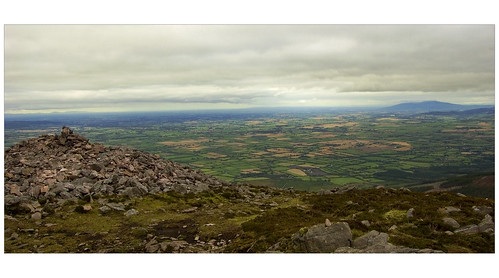 View from the summit of Sugarloaf Hill with Slievenamon in the background
From Sugarloaf Hill, I headed back to the County Wall to descend to the road over some very steep and eroded ground. On the way down, views opened up across Bay Lough and I spent a short while watching to see if Pettitcoat Loose would make an appearance on the bank of the Lough. Heaven knows what I would have done had she done so!
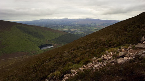 Bay Lough from the slopes of Sugarloaf Hill. Thankfully, Pettitcoat loose wasn't sitting on the bank!
 Unless you have two cars, the final part of the walk requires following the road back to the parking spot at the bridge. Luckily for me, I was only on the road when a rickety old jeep passed me by, slowed down, then stopped before a head popped out of the drivers window offering me a lift. The jeep had seen better days and judging by the smell and the various empty wrappers from sheep-related medicinal products littering the interior, it had also most likely had a history of ferrying sheep along the same road. In any case, I wasn't complaining and was happy of the lift.
The elderly farmer was more interested in talking about the Comeraghs than the Knockmealdowns and seemed genuinely disappointed when I told him that I hadn't walked them yet. However, his interest quickly perked up when I mentioned that I had climbed Slievenamon in the recent past. Upon relaying this fact, I was subjected to a barrage of sheep-related questions, none of which I had the answer to. For some reason, the old man wanted to know if there were any sheep on the mountain and how high up they were. Feeling completely out of my depth, I made up a story that there was a very heavy mist down the day I walked the mountain so I couldn't see my hands in front of my face never mind any sheep in my immediate surroundings. I think he just about bought my story!
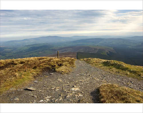
The horseshoe is highly recommended and once the height has been gained, it offers some very easy high-level walking. The downside of starting from the bridge is the steep and eroded descent down from Sugarloaf Hill but I believe there is an easier route down towards the Vee Gap. The walk could be lengthened to include Knocknafallia and Knocknagnauv to the West.
GPS LogAdditional Images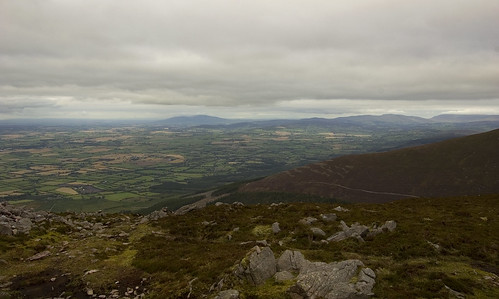 Slievenamon and the Comeraghs from Sugarloaf Hill
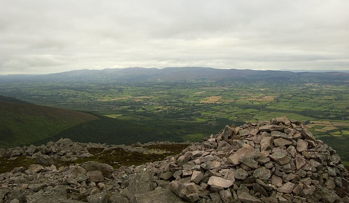
View over the Golden Vale to the Galtee Mountains from the cairn on Sugarloaf Hill
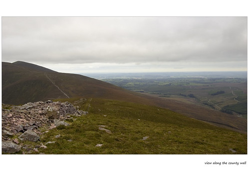
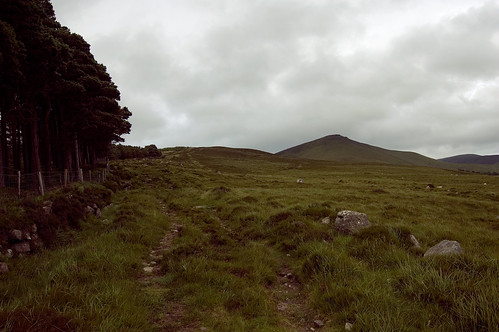
View along the County Wall
View down to the gap on the steep descent of Sugarloaf Hill.