Saturday, 6th August 2011
Staring and Finishing Point: Priests Leap Car-Park
Knockboy
Classification: Dillon, Hewitt, Marilyn, County Top
Height: 706 metres
Dillon Count: 47
The Priests Leap
Classification: Minor Top
Height: 519 metres
Following the now tried and trusted pattern of the previous week, the weather continued to oscillate between periods of warm sunshine and periods of heavy, almost thundery showers. The last day of my holiday began with a torrential downpour before seemingly settling into a prolonged bout of radiant sunshine. Armed with a set of co-ordinates kindly texted to me by my neighbour, I stepped out the front-door of our holiday home into the morning sunshine. The co-ordinates would lead me to the rather infamous Priest's Leap, the starting point of choice for a walk up Knockboy, the highest point in County Cork. It was more in hope than expectation that I entered these co-ordinates into a free GPS application I had downloaded to my iPhone. However, I was pleasantly suprised when, coming into Bonane, the phone patiently prompted me to turn left and when doing so, I caught sight of a small signpost marked 'Priest's Leap Pass'.
In the past, I had read several reports of the drive up to the Priest's Leap and not one of them made pleasant reading. The only small crumb of comfort was that I had been told that the road was far more exposed if approaching from the Glengariff side. The fact that one section of the road wasn't even marked on the OS map didn't much help my frame of mind. However, although very narrow and with passing spots few and far between should another vehicle be met, the road didn't prove anywhere near as bad as I had anticipated. Luckily, the only traffic I met was a friendly local who had no hesitation in shoving his van into reverse and speeding off backwards before skilfully parking the van halfway into a ditch in order to let me pass.
My reliable old workhorse of a car had been dragged up several mountain roads during it's lifetime and it took most of this one in it's stride. The early morning downpour resulted in a continuous river or water running off the mountains and down the upper section of the road. As I passed from the section of road marked on the map to the section that wasn't, I had to engage first gear to make the final steep climb to the top of the pass.
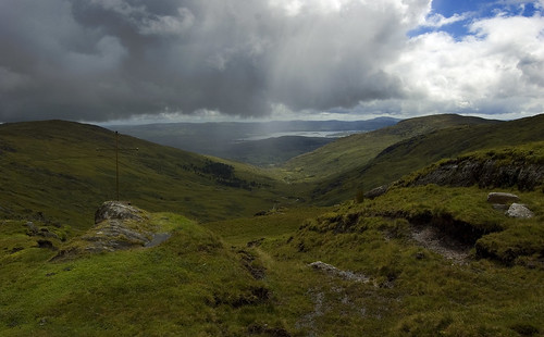
There is a parking spot at the top of the pass close to the cross marking the The Priest's Leap. The parking spot is just about wide enough to accomodate three cars. The cross marks the spot from which legend has it that a priest being pursued by English soldiers jumped with his horse and landed in Bantry several miles away. The views from the top of the pass are simply magnificent, encompassing Bantry Bay to one side and across over the Caha Mountains and the Reeks to the other.

View from Priests Leap
I was so busy concentrating on reaching the top of the pass that I hadn't noticed the change in the weather nor the buffeting wind that was coming across the mountain. However, that soon became apparent when I stepped out of the snug interior of my car and set off uphill towards Knockboy.
As for the walk itself, there's not much I can say to recommend it. It had been described as something of a trudge and I wouldn't vary too much from that description. I was only minutes up the hill when a heavy and prolonged shower of rain arrived to dampen my spirits. To add insult to injury, the shower was swiftly followed by a thick mist. Realising that this had now become a case of bagging the summit as quickly as possible, I ventured on making my way up to Lough Boy. At the Lough, I managed to miss the fence that leads to the summit so took the lazy option of following my GPS instead. The most impressive aspect of the walk was the noise of several streams of water, enlarged by the recent rain showers, cascading down the mountain.

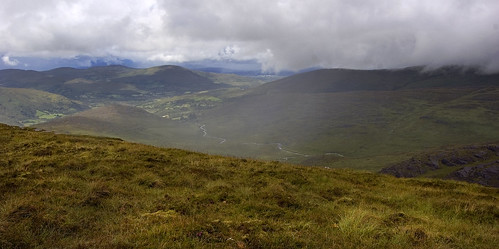
View from Knockboy
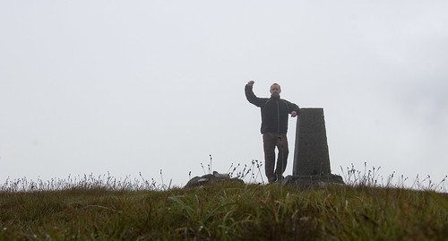
After what seemed like an eternity of trudging through pools of water and muck, the trig point that marks the highest point of County Cork finally came into view. I delayed at the summit long enough to send a text to my neighbour thanking him for his co-ordinates before retracing my steps back down the mountain to my parking spot.
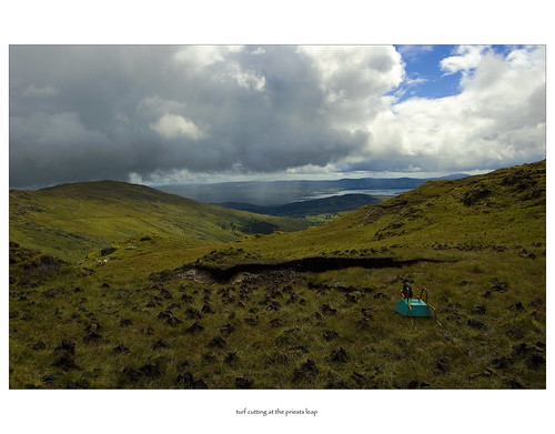
By the time I got back to the car, the weather was showing signs of clearing so I ventured up the hill at the other side of the road. Depending on what map you study, the hill is called Cummeenshrule, Knockboy West Top or Priests Leap. From the carpark, it's a handy walk to the summit which is marked by a pool. The walk took me through some bog complete with cut and stacked turf and offers great views down to Glengariff.

Overall, not one of the most enjoyable walks I've ever been on. I've been told the views from Knockboy on a clear day are stunning and I'm sure the walking would be a lot easier in drier conditions. One to save for a sunny summer's day (if you are lucky enough to get one!)

No comments:
Post a Comment