Date First Walked: October 5th 2009
Range: Wicklow Mountains
Mapsheet: 56
Distance: ????
Ballineddan Mountain
Classification: Dillon
Height: 652 metres
County: Wicklow
My Dillon Count: 12
Slievemaan
Classification: Dillon, Marilyn
Height: 759 metres
County: Wicklow
My Dillon Count: 13
Slievemaan
Classification: Dillon, Hewitt, Marilyn, County Top (Wicklow)
Height: 925 metres
County: Wicklow
My Dillon Count: 14Fresh from the excitment of Sawel and Errigal the previous day, another early start saw me on the road and heading for Wicklow, this time with my sometimes walking colleague Jason for company. For some reason, I find it difficult to get excited by the Wicklow Mountains in the same way that I'd look forward to a walk elsewhere but the prospect of climbing the highest point in both Wicklow and Dublin added a little bit of spice to the walk.
The route of this walk was to pass through the Glen of Imaal Artillery Range so we'd checked the previous week to ensure there would be no firing on the day we intended walking. You can do this by calling the Army Range Warden Service in Seskin School on 045 405653. Just to be sure, we called into Seskin School to double-check on the morning of the walk. The school looks like it hasn't changed since the days it was actually used as a school and after a couple of rings on the doorbell which turned out to be broken, Jason let out a couple of yells of 'Hello' and was greeted with replies of 'Come In' from inside.
The HQ proved to be no more salubrious on the inside and we followed the noise of a TV to an office at the end in which sat a rather portly spectacle-clad middle-aged man in army uniform. The man was in the midst of enjoying a cup of hot tea while battling with a multitude of pullouts and supplements that made up his Sunday broadsheet. With one eye skirting over the front-page headlines about the massive wastage of taxpayers money by Ceann Comhairle John O' Donoghue, the man was also trying to take in an episode of the comedy show 'Love and Marriage' which obviously made up RTE2's Sunday morning schedule. We were provided with a couple of recommended 'safe' routes up Lug and were told that it was alright to descend via Camara Hill. We left the Range Warden Service HQ content that we would not be met with any stray grenades and on the way out, we passed some American tourists who seemed to be slightly confused about the 'Army' building they were approaching.
We started our walk from the woods at Ballinfoyle which is a couple of kilometres away from the 'Dwyer McAllister Cottage'. Some parking is available on the roadside and a gate leads straight onto the slopes of Ballineddan. We quickly realised that we could put away our compasses as the way up the mountain was marked by a very distinct track caused by the dreaded quad bikes. From the gate, it's a pretty leisurely walk up to the small summit cairn on Ballineddan from which there are views across the shoulder to Slievemaan with the large mass of Lugnaquilla behind it.
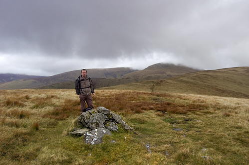
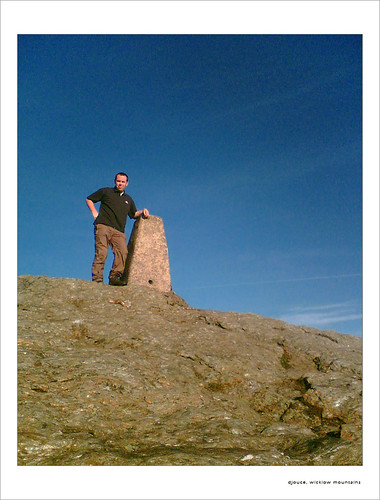
Me on the summit of Ballineddan
The quad track continued across the shoulder and on on up to Slievemaan with a short walk of about 1km leading to the small summit cairn on it's summit. Unfortunately, the summit is badly eroded with the small plateau something of a quagmire as it appears that the quad bikers use this as a place to perform turns ripping up the ground.
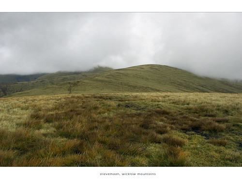
The scarred slope leading up to Slievemaan
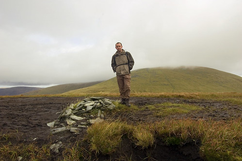
Cairn on the heavily eroded summit of Slievemaan
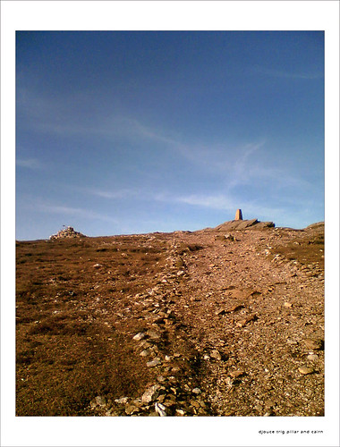
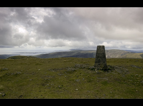
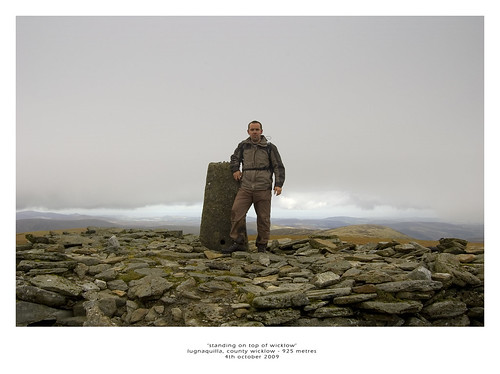
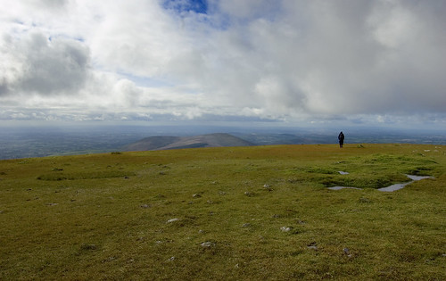
Slievemaan gives a view across to the giant lump that is Lugnnaquilla whose summit is less that 200 metres higher. Unfortunately, the scars continue on up the face of Lug and the gap between Slievemaan and Lug is extremely boggy in places. From the gap, it's a slightly steeper climb up the south-western face of Lug upto the flat summit plateau known as 'Percy's Table'. Whilst we had clear conditions on top of the mountain, I've been told it can be a confusing place in mist and the impressive 'Prisons' on either side pose obvious dangers. A walk along the summit plateau leads to the huge cairn topped by a trig pillar marking the highest point of the mountain but don't expect to have the summit to yourself as it proved to be busier that my local village shop during our stay there. A directional indicator housed in a rather unsightly square of concrete sits beside the summit cairn and helps sort out the impressive views which look across the Wicklow Range and over to Mount Leinster and the Galtee Mountains to the South West.
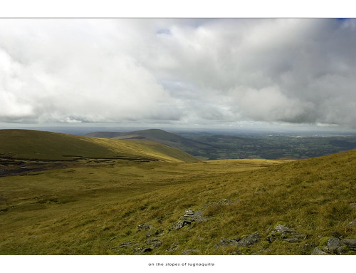
Lower slopes of Lugnqauilla
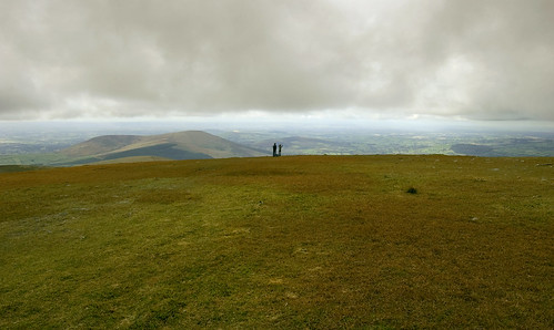 Photo Op on Lug
Walk back along the plateau taking care to avoid the North Prison and descend the Western Slope in a slight North Westerly direction towards Camarahill. You are now within the confines of the artillery range so only take this route when you are sure no firing is taking place. The last word of caution is to beware of a very muddy area at the foot of Lug as I found that it contains the dreaded floating bog and ended up with one leg waist high in bogwater and a broken camera! After crossing Camarahill, you will reach a stretch of road called 'the Banana Road' - walk a short distance on this and take the first turn to the left which after around 1km will lead across a stream which can be forded across a series of rocks. After crossing the stream, you meet a larger road and need to turn left and follow the road for around 1.5km back to where you parked up at Ballinfoyle.
All in all, quite a handy walk especially when you take into account the height gain. Don't expect to have the hills to yourself as Lug's proximity to Dublin ensures that there is always plenty of walkers on the hills. There are better walks to the summit available from the Glenmalur side of the mountain.
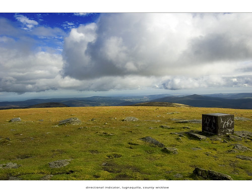
Directional Indicator on Lug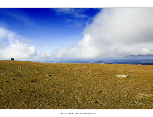 Percy's Table, Lugnaquilla
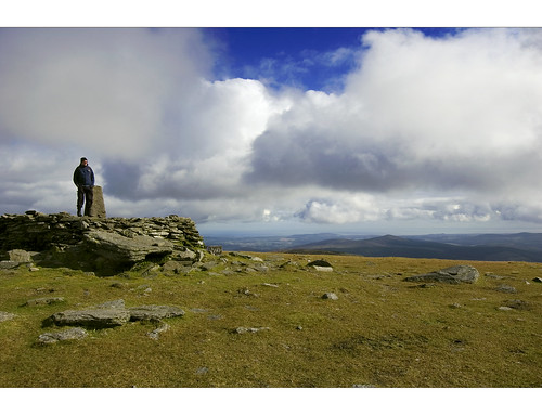
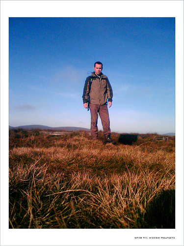
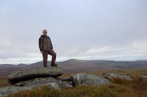
Jason on the summit of Lugnaquilla
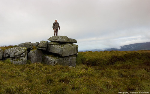
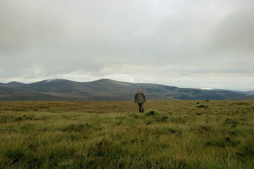
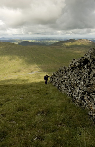
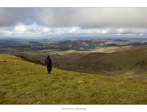
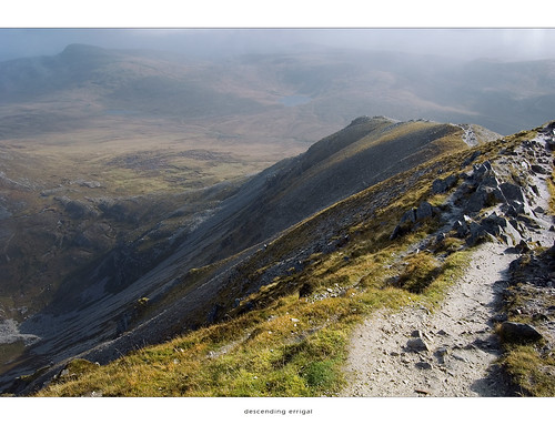
 Jason descending Lugnaquilla
Jason at the North Prison, Lugnaquilla
Date First Walked: October 4th 2009
Range: Derryveagh MountainsStarting/Finishing Point: See Map Below
Mapsheet: 1
Distance: ????
Classification: Dillon, Hewitt, Mailyn, County Top
Height: 751 metres
County: Donegal
My Dillon Count: 11
An absolute peach of a mountain! Another of Ireland's iconic mountains and one that I'd been wanting to climb for some time. Having climbed Sawel earlier in the day in gale conditions, I had hoped that my drive from Tyrone to Donegal would see the worst of the weather pass over. The drive took me through the full range of Irish weather, from bright sunshine to heavy showers but as I turned a corner some miles from Leterkenny, I was treated to the wonderful sight of a full rainbow sitting over Muckish mountain. A few miles up the road, I got my first glimpse of Errigal looking imposing and magestic as it sat under a dusting of rapidly passing cloud.
Errigal quite simply looks like a proper mountain. There are some mountains in Ireland that look like big hills, some of the rounded tops of Wicklow for example but Errigal despite is relative lack of height, just looks the part. The mountain appears to change shape as you drive around it and it totally dominates the small village of Dunlewy with it's steep western slopes leading up to it's superb serrated edge on top. The quartzite that characterises the mountain appeared to gleam brightly when hit by the odd sporadic ray of sun that somehow managed to escape the cloud cover. The wind failed to die down and I questioned the sensibility of climbing the mountain in such counditions but the appearance of another car in the carpark at the foot of the mountain gave me a bit of courage and I decided to head up. I found further comfort when another walker appeared at the foot of the mountain and began to make his way up the lower slopes.
Parking Spot for Errigal View Larger Map
The traditional way to climb Errigal is from the carpark a mile or so outside Dunlewy at the foot of the mountain. From the carpark, a walk across heavily eroded and boggy ground leads to a very visible track of shiny scree and this is where the climb really begins. The ground is quite steep but it's a relatively short climb before you reach the lower ridge which has a collection of cairns and a stone shelter. There is quite a steep incline to the right along this ridge so it might not be for those who do not have a good head for heights. From the ridge, it's a pretty straightforward climb up to the first top which is the highest at 751 metres. A short narrow track called 'One Man's Pass' leads across to the twin summit which is slightly lower.
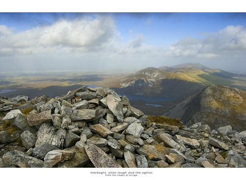
I had been accompanied with gusting wind on my way up Errigal, the kind of wind that you can hear coming a few seconds before it hits you and this made the walk across the ridge that bit more exhilirating and indeed terrifying. There were are few times where I had to crouch down and take hold of rock as the wind threatened to knock me off my feet but I was delighted to make the summit, possibly the smallest summit of any of the 'Dillons' - it really is tiny. You really do feel like you are on top of the world on the summit of Errigal and the view down to Makoght, Altan Lough and the Aghlas immediately below is breathtaking as is the view back across the Poisioned Glen and out towards the coast. The gust factor just stayed on the right side of terrifying while on the summit although I stayed sat firmly on my backside for the duration of my time at the top of Donegal.
If the conditions are windy, the best bet is to retreat from the top back down to the circular stone shelter for refreshments which is exactly what I done. One word of warning - lower down as you descend the scree, make sure to take care as this is probably trickier than the ascent.
Errigal is one mountain that I simply cannot recommend highly enough. It certainly wouldn't be everyone's cup of tea in such high winds but on a calm sunny day, it would be a complete different proposition. The views from the top are superb and like I said, it's one Irish mountain that really does feel like a proper mountain.
My favourite so far and one that I'll definitely be returning to.
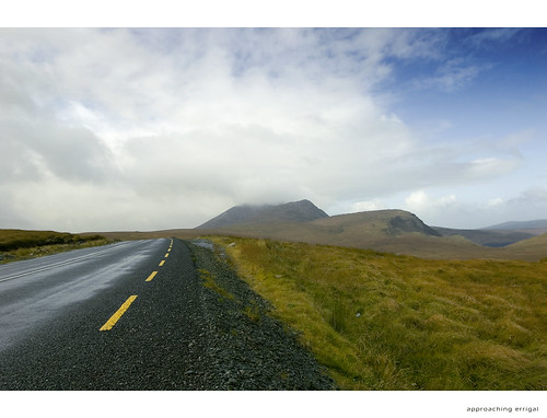
Approaching Errigal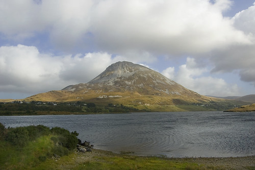 Errigal from Dunlewy
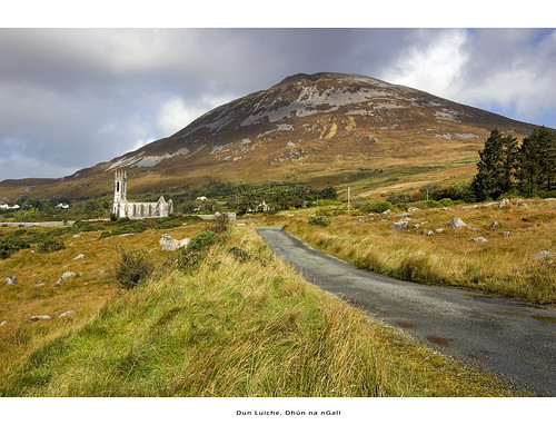 Ruined Dunlewy church and Errigal
 Climbing the scree with Poisioned Glen in the background
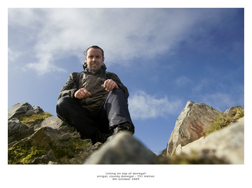 Sat on the summit - on top of Donegal
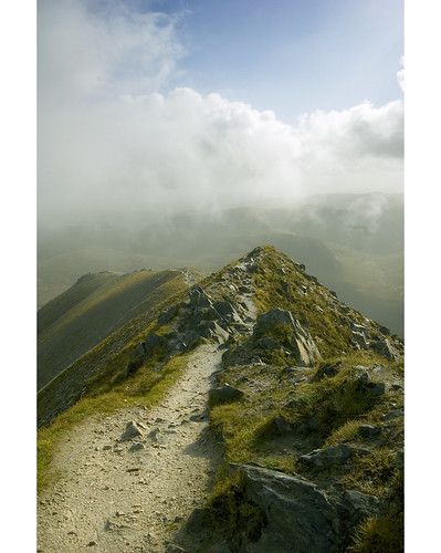 View back along the ridge - shelter is at the end of the ridge
 Another view along the ridge
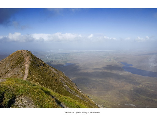 One Man's Pass
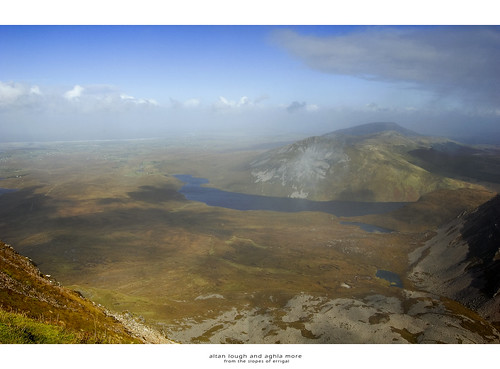 Altan Lough and Aghla More
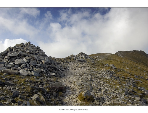 Cairns at the lower end of the ridge
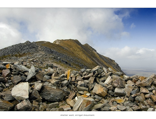 Shelter wall with the ridge in the background
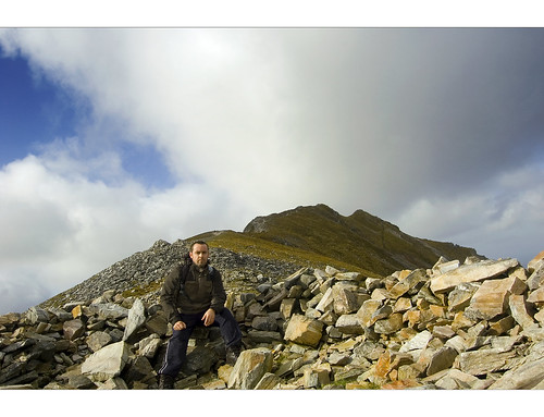 Gimme shelter - me taking shelter from the wind
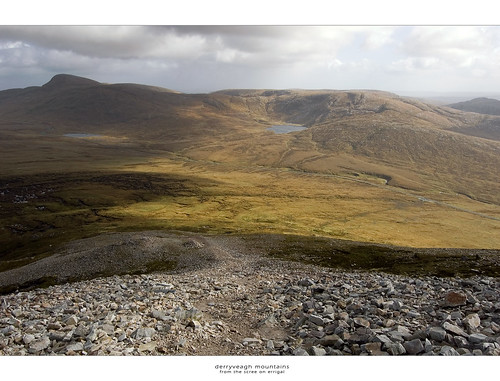
Derry veagh mountains from the scree on the way back down
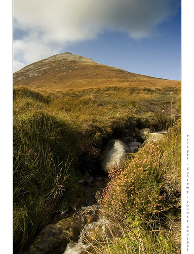 Errigal from the stream close to the carpark
Date First Walked: October 3rd 2009
Range: Sperrin Mountains
Mapsheet: 13
Distance: ????
Classification: Dillon, Hewitt, Mailyn, 2 County Tops (Derry and Donegal)
Height: 678 metres
County: Derry/Tyrone
My Dillon Count: 10
Something of a very minor milestone - my 10th Dillon!
Another quick up and down as I done Sawel as part of an effort to get to the highest point in each county in Ireland. Despite forecasts of high and gusty winds, I decided to take my chances and made an early start and headed for the Sperrin Mountains.
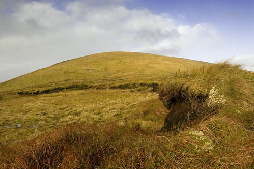
Sawel can be included as part of a long walk of the Sperrins but its summit can be easily reached by climbing the East shoulder from the road between Sperrin and Port. Travelling the narrow road from the Sperrin direction, park up at the layby on the right after the second cattle grid. Cross the road and follow the fence uphill which acts as a guide most of the way to the summit of Sawel. The lower parts of the mountain are boggy in places with numerous peat hags and wet areas to be encountered. As you gain height, the boggy ground gives way to a nice covering of grass more akin a country field than the upper reaches of a mountain.
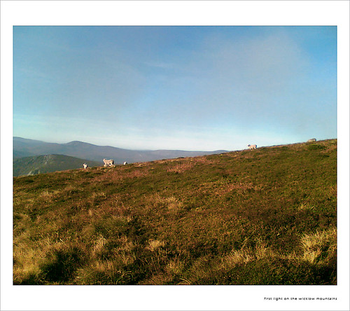
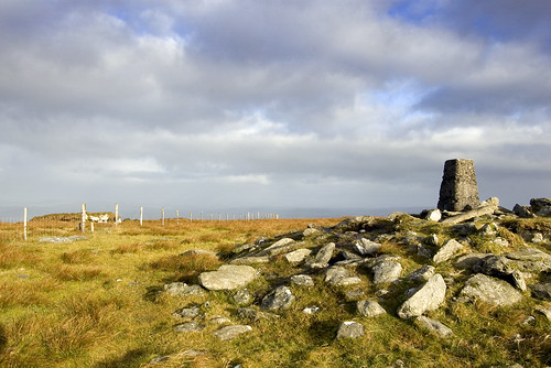
My walk to the top was done with the rising sun on my back and it lit up and painted the Eastern slopes of Sawel in bright and vivid colours. I was sheltered most of the way to the top but as I got within 200 metres of the summit, I could hear the wind howling across from the direction of Dart Mountain to the West. Crossing the crest of the hill, I was nearly blown off my feet and my plans to cross over to Dart were quickly cancelled for another day. The summit proper is just a short distance to the right of the fence which marks the county boundary between Derry and Tyrone and consists of a raised mound of rocks topped by a trig pillar. On the other side of the fence were a dishevelled looking group of sheep desperately huddled on the eastern side of a large peat hag in a vain effort to avoid the worst of the winds. The sheep seemed to look at me jealously knowing that I could gain shelter by heading back down the east side of the mountain from which they were denied access by the fence - their options were limited to staying put and sitting out the gale or heading back towards Dart running the high risk of having the wool blown off their backs. Such was the strength of the wind that I was blown off the crest containing the trig pillar on a couple of ocassions so I quickly retreated back to a more sheltered area.
For anyone gathering county tops, the summit proper of Sawel is actually in County Derry with the highest point in county Tyrone lyning some 30 or 40 metres away just across the fence down the southern slope of the mountain. To date, nothing marks this very important spot so perhaps someone will take it upon themselves to construct a small cairn there!
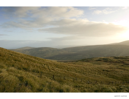
Sunrise over the Sperrin Mountains
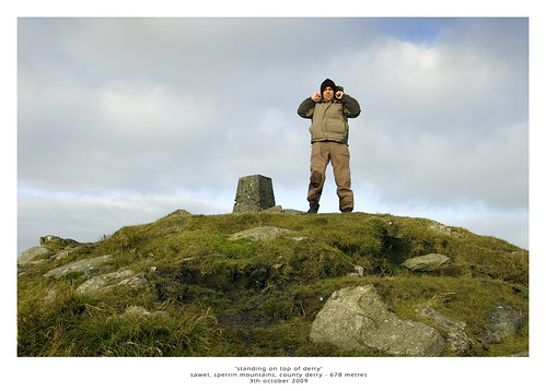
Me on the summit of Sawel holding onto my hat!
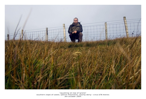
The highest point in Tyrone on the southern slopes of Sawel
Peat Hag on the slopes of Sawel
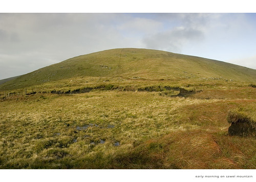
Early morning on Sawel
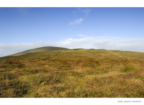
Sawel from it's lower slopes
Date First Walked: August 6th 2009
Range: Derrynasaggart Mountains
Mapsheet: 79
Distance: Circa 8km
Classification: Dillon, Hewitt, Marilyn
Height: 694 metres
County: Kerry
My Dillon Count: 8One of Ireland’s iconic mountains and it’s easy to see why it cast such a spell on the pre-Christian inhabitants of the area. The mountain was known in Celtic times as Dá Chích Anann which translates as ‘the two breasts of Anu’, Anu being the principal goddess of pre-Christian Ireland. Driving from Mallow to Killarney, it’s easy to see where the mountains got their name consisting as they do of two breast-like peaks with the summit of each marked by a huge ancient stone burial tomb.
I took an early start while on holidays to tackle the Paps. From Killarney, take the Ballyvourney road then take the first turn-off for Clonkeen. This will take you past Clonkeen church and shortly afterwards you need to take the road to the left signposted ‘Clydagh Valley’. Follow this narrow road for just over 2.5 miles after which you will see a laneway/trail to the left surrounded by some farm buildings and some evergreen trees. There is space here to park your car.
Follow the laneway which leads through 3 gates. After the third gate, you will see a firebreak in the trees to the left which you need to follow up the slopes of Paps East. Note that the climb up this firebreak is very steep and extremely wet and slippy in places but it’s only a relatively short climb up to the open slopes of the mountain. Once on the slopes, pick a pathway bearing slightly right up to the summit through heavy heather which can be quite tough going in places. You will pass by the remains of what are probably ancient dwellings on the way up.
As the mist came across the mountain, I had one of those moments where I wondered why I was out of my bed so early in the morning battling my way through heavy heather to the summit of a mountain that looked like it would be covered by mist! After a false top, you can’t fail to spot the massive cairn on the summit which is the higher of the two.
From the first summit, you can head across to the second, western top but make sure not to stray too close to the cliffs that run down to Lough Negeeha. The worsening weather and the low visibility made me decide to give the second Pap a miss until another day so I retraced my steps back to the firebreak. Take care when descending this part as it can be treacherous in places particularly after a wet spell. Once at the bottom of the firebreak, follow the laneway back to your car.
The laneway with Paps East to the left
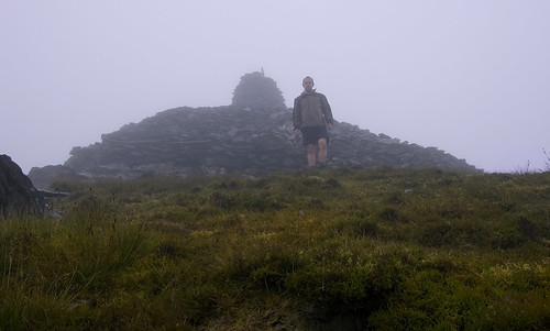
Me in the mist on the summit of Paps East
Date First Walked: August 4h 2009
Range: Derrynasaggart Mountains
Mapsheet: 70
Distance: ????
Classification: Dillon, Hewitt, Marilyn
Height: 649 metres
County: Cork/Kerry
My Dillon Count: 7Another day, another mast! While leafing through Paddy Dillon’s Bible on holidays in Kerry, I chanced upon Mullaghanish. I hadn’t intended taking in another mountain topped with a huge RTE mast so soon after Kippure but it presented the perfect opportunity to take the kids for a walk up its meandering access road. Indeed on the OS map, the access road appeared as series of corkscrew bends indicating that it wouldn’t be overly steep and that proved to be the case.
The mountain is a little bit awkward to find, signposted to an extent from Ballyvourney on the Killarney side of the village. Follow the cycle-route signs and you should find yourself at a locked gate at the foot of the access road. If anything, the road meanders a little bit too much meaning that for most of the walk, you don’t appear to be getting any closer to the top of the mountain but a straighter section towards the top eventually leads to the summit. The walk to the top does however give you ample time to enjoy the ever-widening views across to the iconic Paps in the near distance.
Even putting to one side the aforementioned mast, the summit of Mullaghanish was the most disappointing yet looking more like a building site than a mountain-top with a large portion of it cordoned off with steel fencing due to ongoing works. To add to our woes, thick cloud cover had closed in as we reached the top closing off any views we might have had from the part of the summit we were confined to. The walk back down the road was made before a spectacular sunset prior to the onset of twilight. All in all, a plain looking mountain not helped at all by the mast and the ongoing development on its summit - one to get out of the way and if you can combine it with a family walk then all the better!
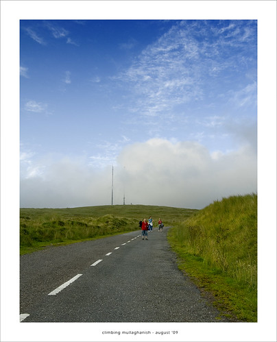
Starting out on the access road
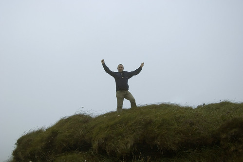
On 'the summit'