
Slievelamagan
Classification: Dillon, Hewitt, Marilyn
Date Walked: 7th February 2010
Height: 704 metres
County: Down
My Dillon Count: 24
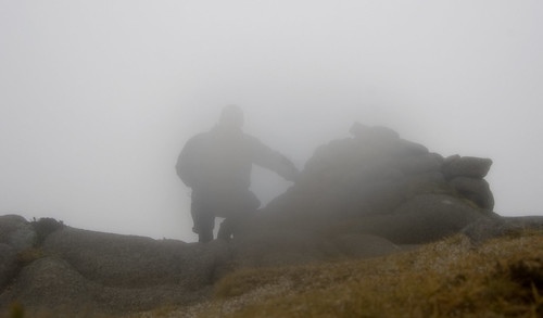
The Mournes.. When they are good, they are good but when they are bad... well, they are just horrid! On this particular morning, they were akin to the stereo-typical teenager on a lazy Sunday morning - lying under a thick blanket and refusing to get out of bed! I arrived at an empty Annalong Car-park to a blanket of fog so thick that you could almost taste it. The normally scenic drive from Newry out through Warrenpoint, Rostrevor and on towards Annalong offered up no views of the hills whatsoever. As I set off walking from the car-park, I could barely see the wall from one side of the laneway to the other and the fog had painted anything that I could see in a million shades of grey.
What mornings like this do provide is an opportunity to test out some navigation skills. The various tracks and trails around the Mournes (along with the Wall) offer a level of comfort and provide surely one of the best locations for cutting your navigational teeth. The walk from the car-park to the gap between Binnian and Slievelamagan demonstrated this fact with a very distinct track leading the way which was just as well as the fog along this stretch was as thick as I had experienced. I passed by Annalong Wood barely able to see the trees, walked by an invisible Blue Lough and trailed along the foot of Slievelamagan without being even able to glimpse it it's famed steep slopes. There is something a bit unnerving about being at the bottom of something so massive, fully aware that it is there yet unable to see it. The track does branch off in a few places and I would highly recommend the excellent OSNI 1:25000 map which has each branching faithfully reproduced.
When you reach the point where the track is crossed by another distinct trail running from Binnian across to Lamagan, simply bear right and follow this second track up the slopes of Slievemagan. This was my first walk with a GPS having borrowed a friend's to try out. After taking a compass bearing to the summit at the gap, I also marked a waypoint as I wasn't sure how distinct the track up Lamagan would be. It turned out to be more a dual-carriageway than a track so much so that I was half expecting to see a retail park plonked somewhere along the climb. What the GPS does offer is another layer of comfort in such poor visibility as well as a countdown informing you how far you have to go to reach the summit.
I had read that Slievelamagan was the hardest of the high Mournes peaks to climb. Indeed, it's name translates as 'the creeping/crawling moutain' or 'by hands and feet' supposedly so called because of it's relentlessley steep slopes. Given that I couldn't see these relentlessley steep slopes, I had no idea what I was facing into but I was relieved to find that the pull to the summit wasn't as tough as I had anticipated and I soon found myself at the large cairn. The reputed great views of the range were denied to me due to the fog which was so thick at the summit that my camera packed in due to the dampness. I had provisionally planned for a traverse to Cove but decided to leave that for another day and retraced my steps back down to the gap.
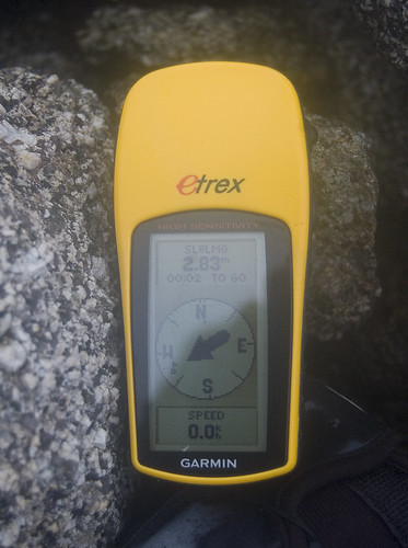
SLVLMG 2.83m
At the gap, I threw my coat into my backsack and jogged back down the track through Annalong Valley. The run took me back past the hidden Blue Lough and along the edge of the barely visible forest. Ever so often, a group of walkers would suddenly emerge from one side of the soup-like fog before quickly disappearing into the other side. My legs were heavy by the time I got back to the car park and I resolved to purchase some trail runners for my next trip to the Mournes.
GPS Info
Download the gps trace (as .gpx format)
No comments:
Post a Comment